
A Community of Communities

On January 1, 1970, the Municipal Corporation of the Town of Fort Erie came into being. Before this, Bertie Township was comprised of distinct villages and small settlements. Some prospered. Others disappeared. Many changed their names or amalgamated with neighbouring communities. Together, they form the rich and diverse history of greater Fort Erie.
This online exhibit celebrates the history of each of these communities through maps and images that tell the story of Bertie Township over 175 years.
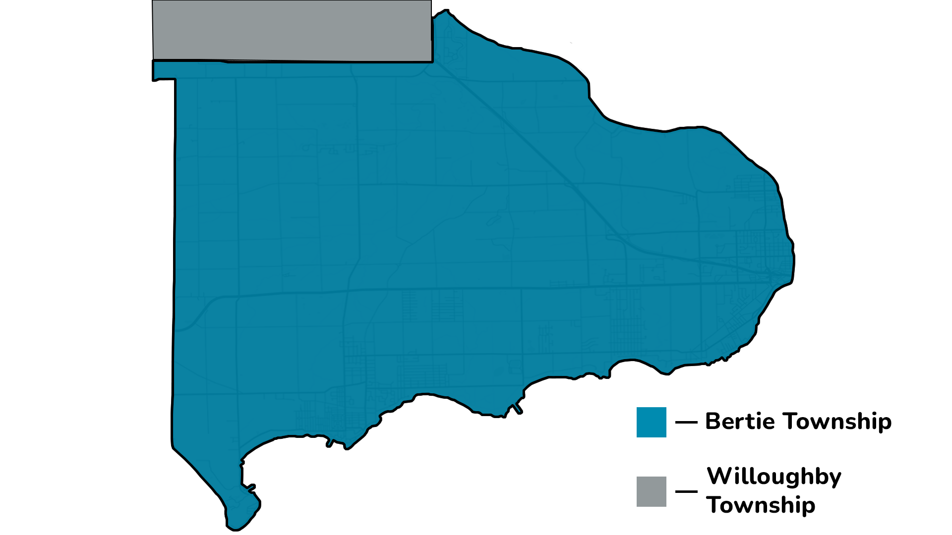
Bertie Township
On a current map, Bertie Township would fall roughly between the Niagara River, Holloway Bay Road, Netherby Road and Lake Erie. It was named in 1793 by an Act of Parliament and was formally incorporated in 1850.
The Village of Fort Erie was the first to break away from Bertie Township and incorporated in 1857. The Village of Bridgeburg followed in 1895. Then, in 1921, the Village of Crystal Beach broke away and incorporated.
From 1931 until 1970, Bertie Township encompassed the remaining portions of the original township. In 1970, most of historic Bertie was reorganized and incorporated as the Town of Fort Erie.
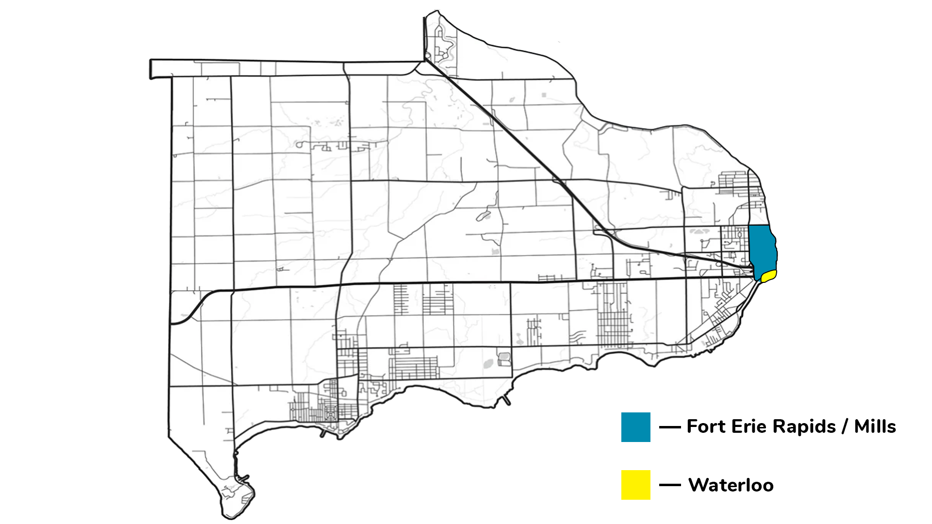
Fort Erie Rapids/Fort Erie Mills/Waterloo
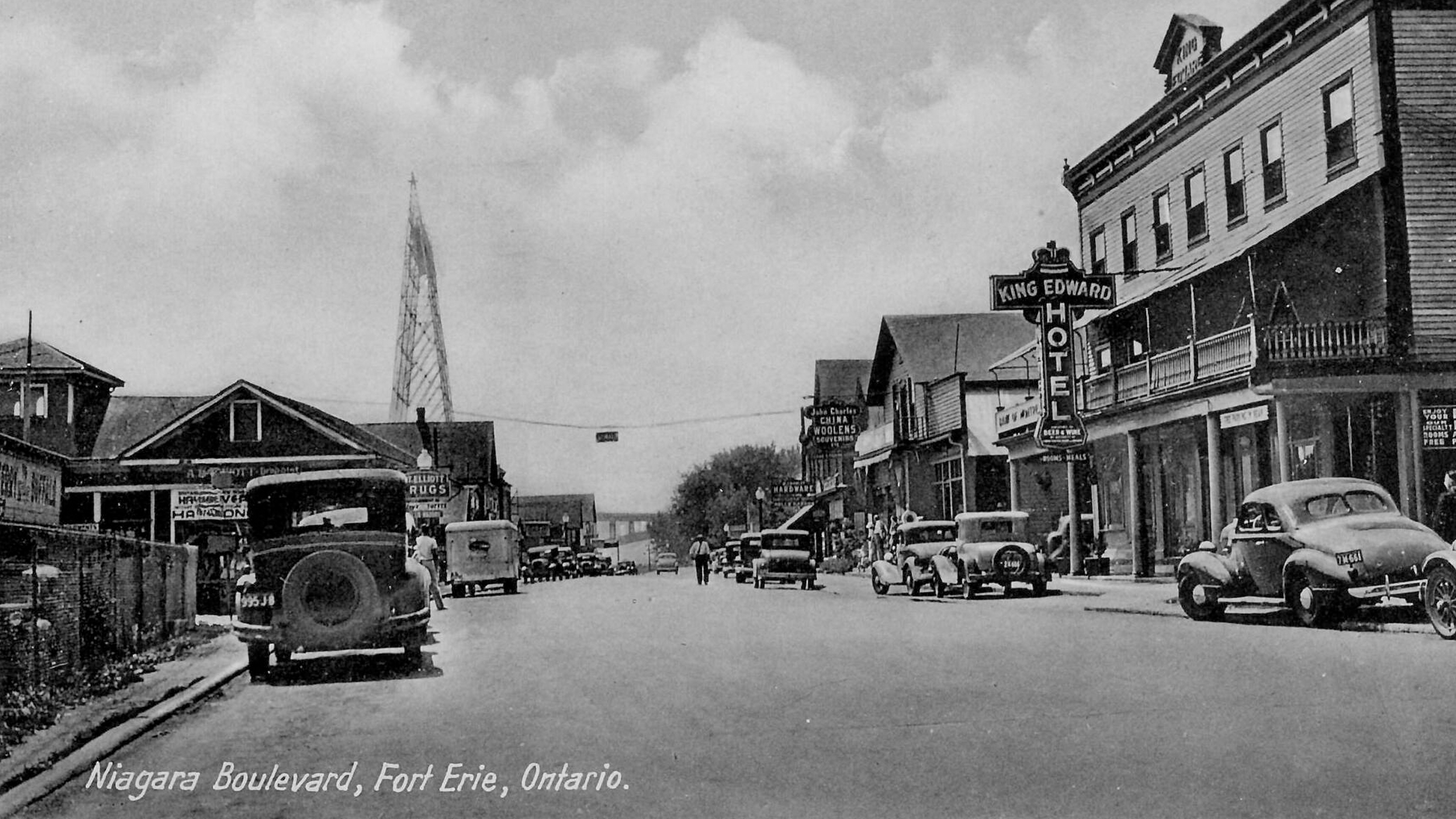
Fort Erie first developed in the 1790s around the area where the Peace Bridge stands today. The settlement had many names including Fort Erie Rapids or Fort Erie Mills. The growing settlement was known as Waterloo until 1857 when it incorporated as the Village of Fort Erie. This image shows a view of Niagara Boulevard looking south. The Fort Erie ferry landing is seen on the left.
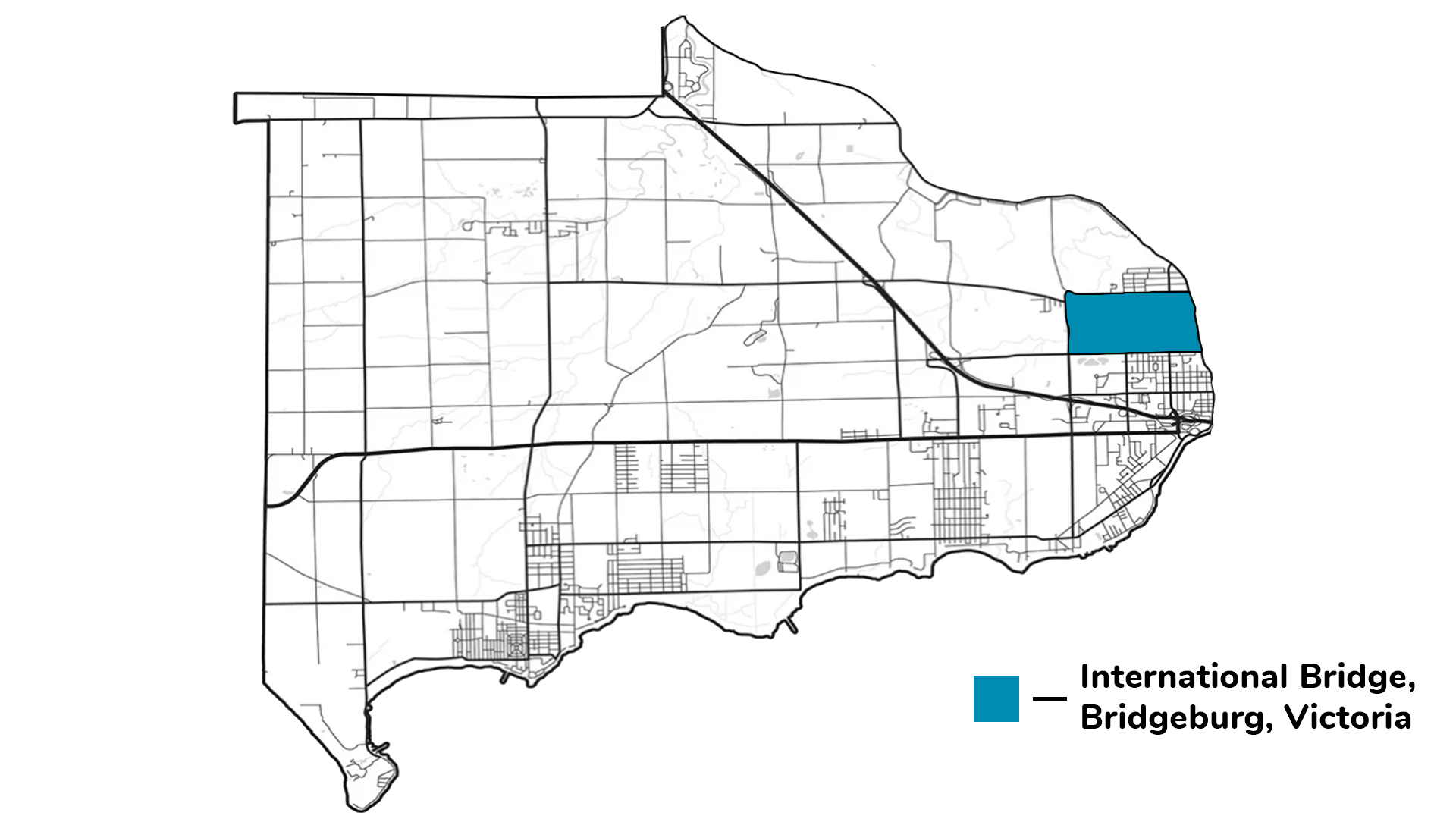
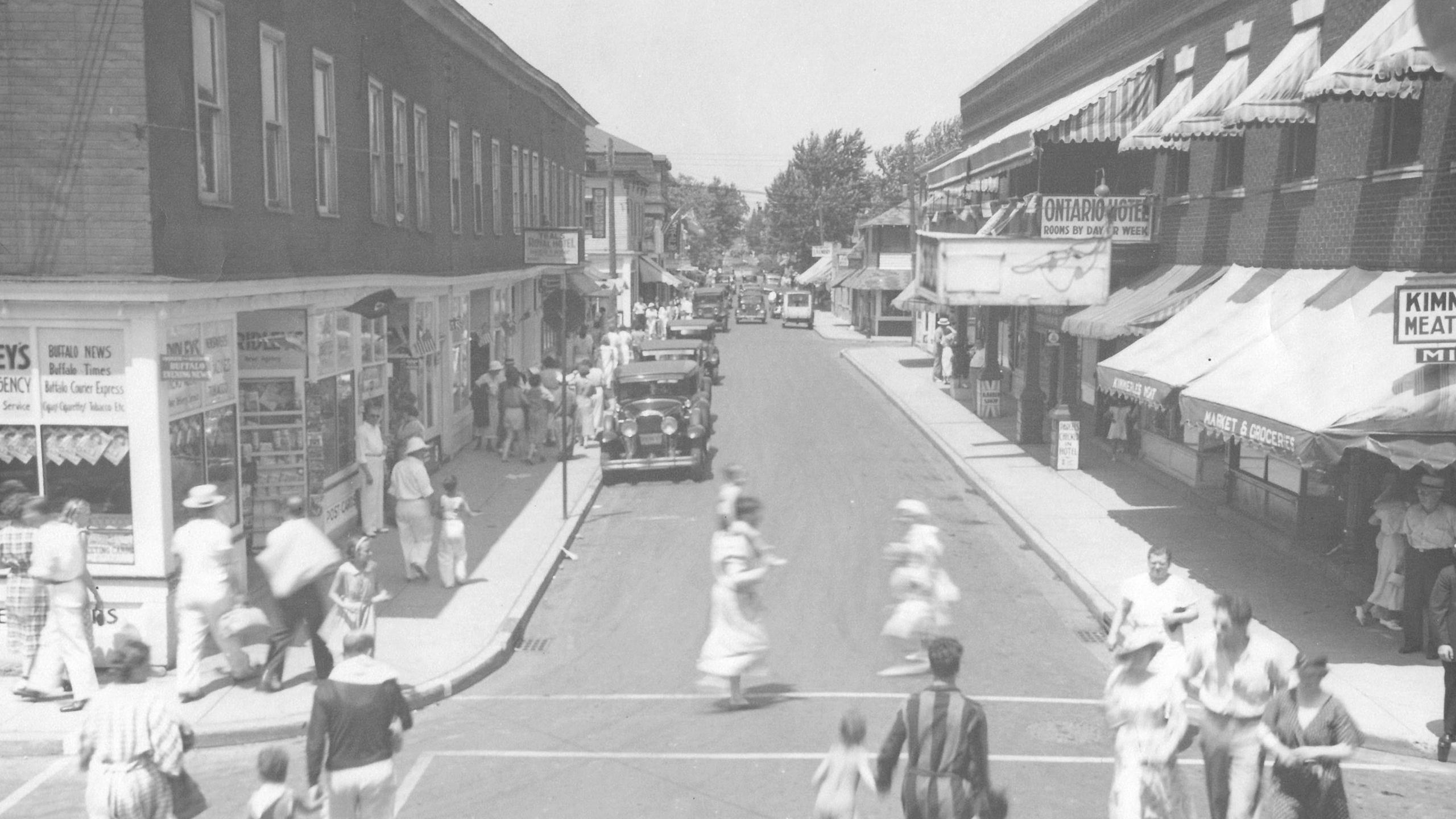
Bridgeburg
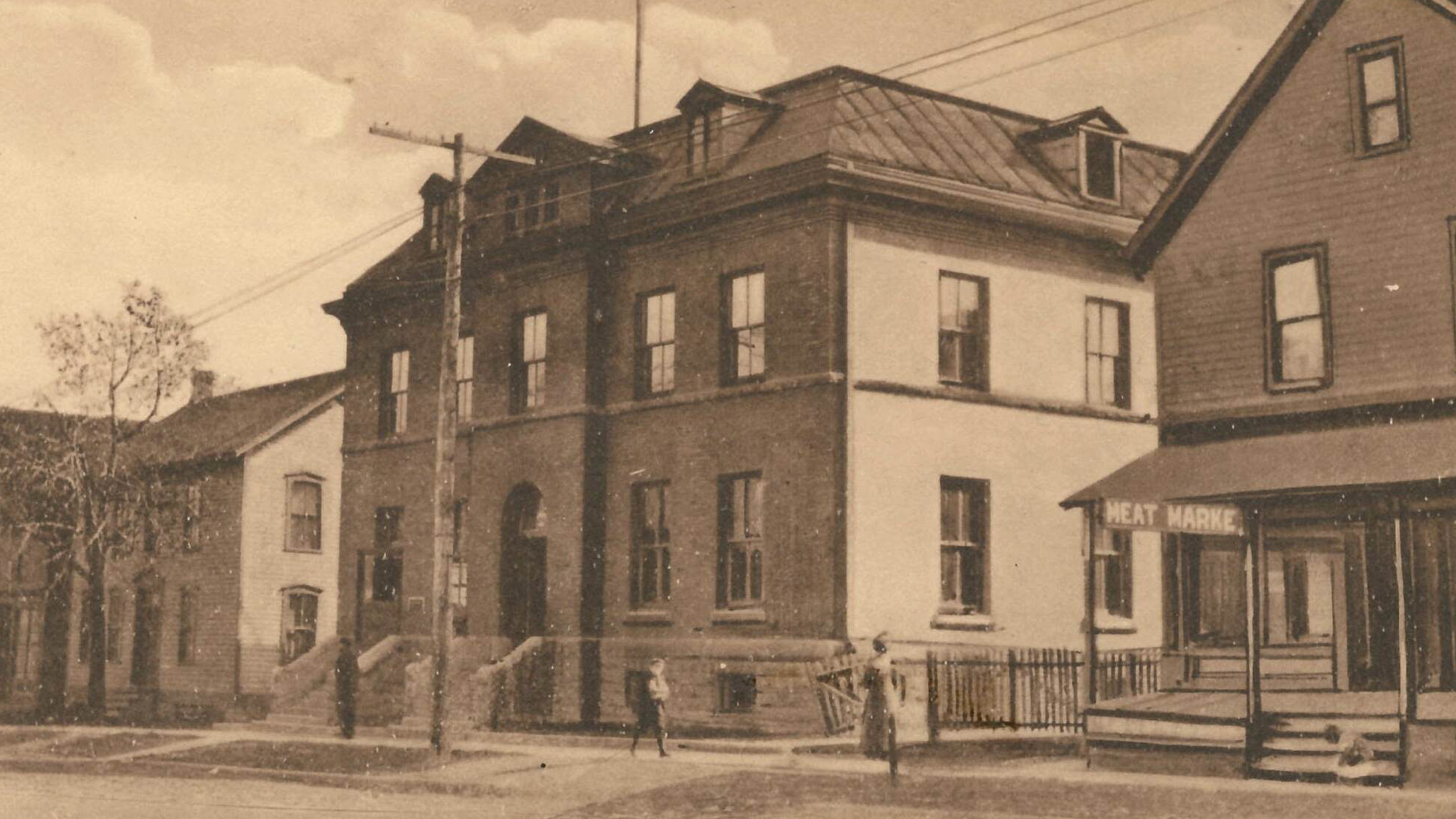
The village that developed north of Fort Erie was called Victoria until 1877. At this time a post office was opened, and the name International Bridge was selected. When the community broke away from Bertie Township in 1895 it was incorporated as the Village of Bridgeburg. This building was the post office and customs building located on Jarvis Street. (Photo A)
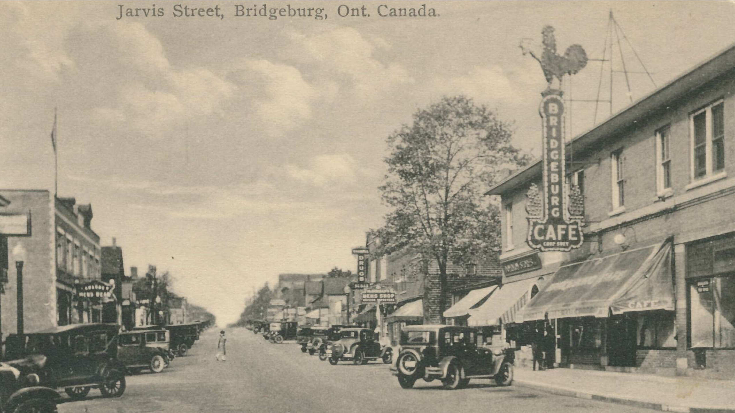
Bridgeburg was a prosperous railway town with many shops and industries. This view of Jarvis Street in Bridgeburg was taken some time between 1924 and the 1940s. The Bridgeburg Café was built in 1924. (Photo B)
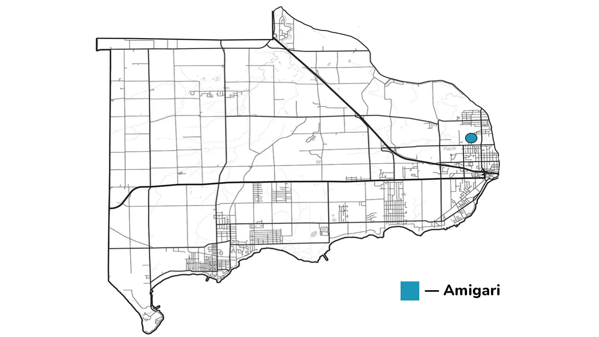
Amigari
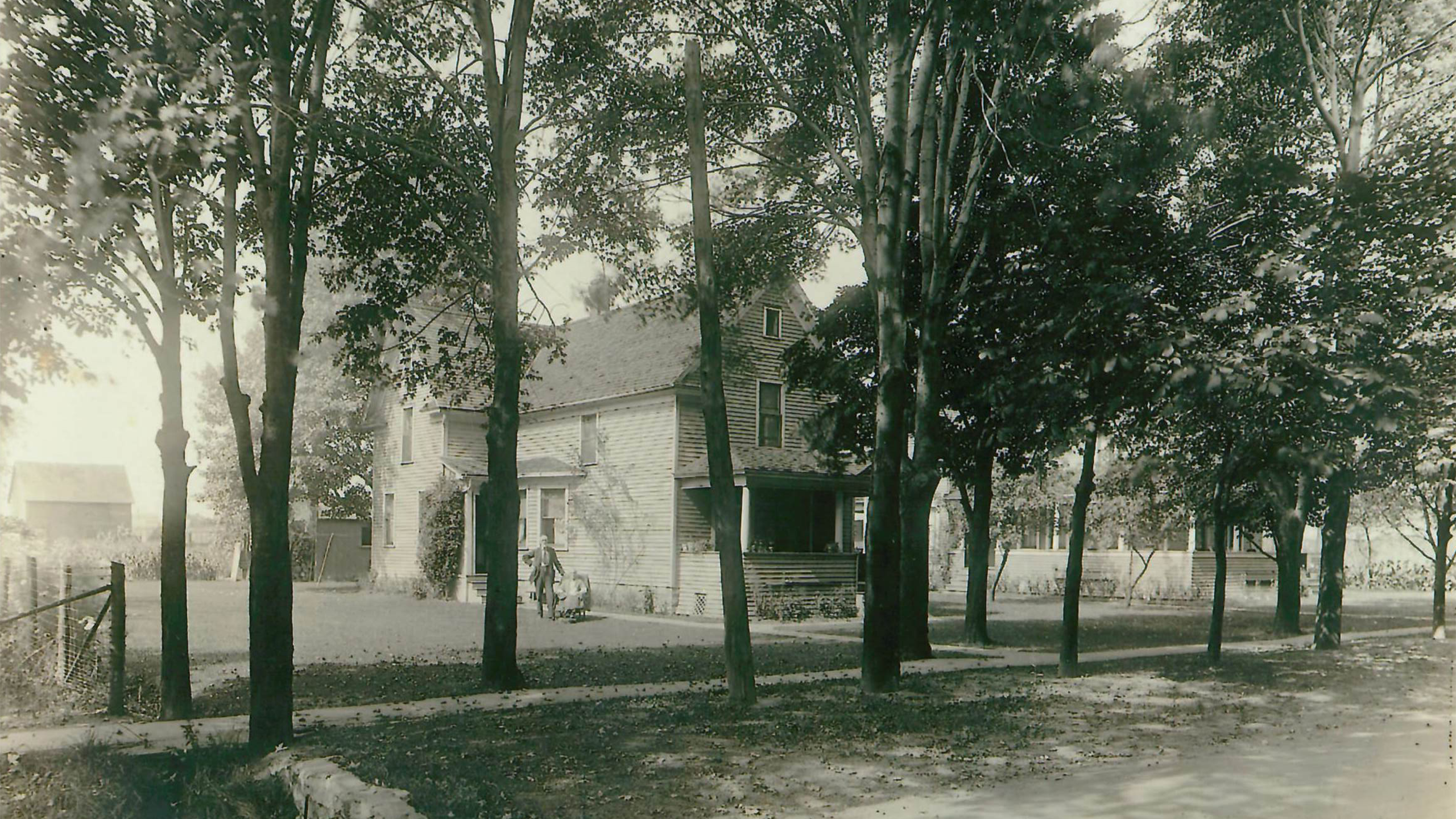
Amigari was a small settlement that was formed around the train station. It left Bertie Township in 1931 and joined the expanded Town of Fort Erie. This house, located in Amigari, belonged to the Mcleod family. The photo was taken around 1924.
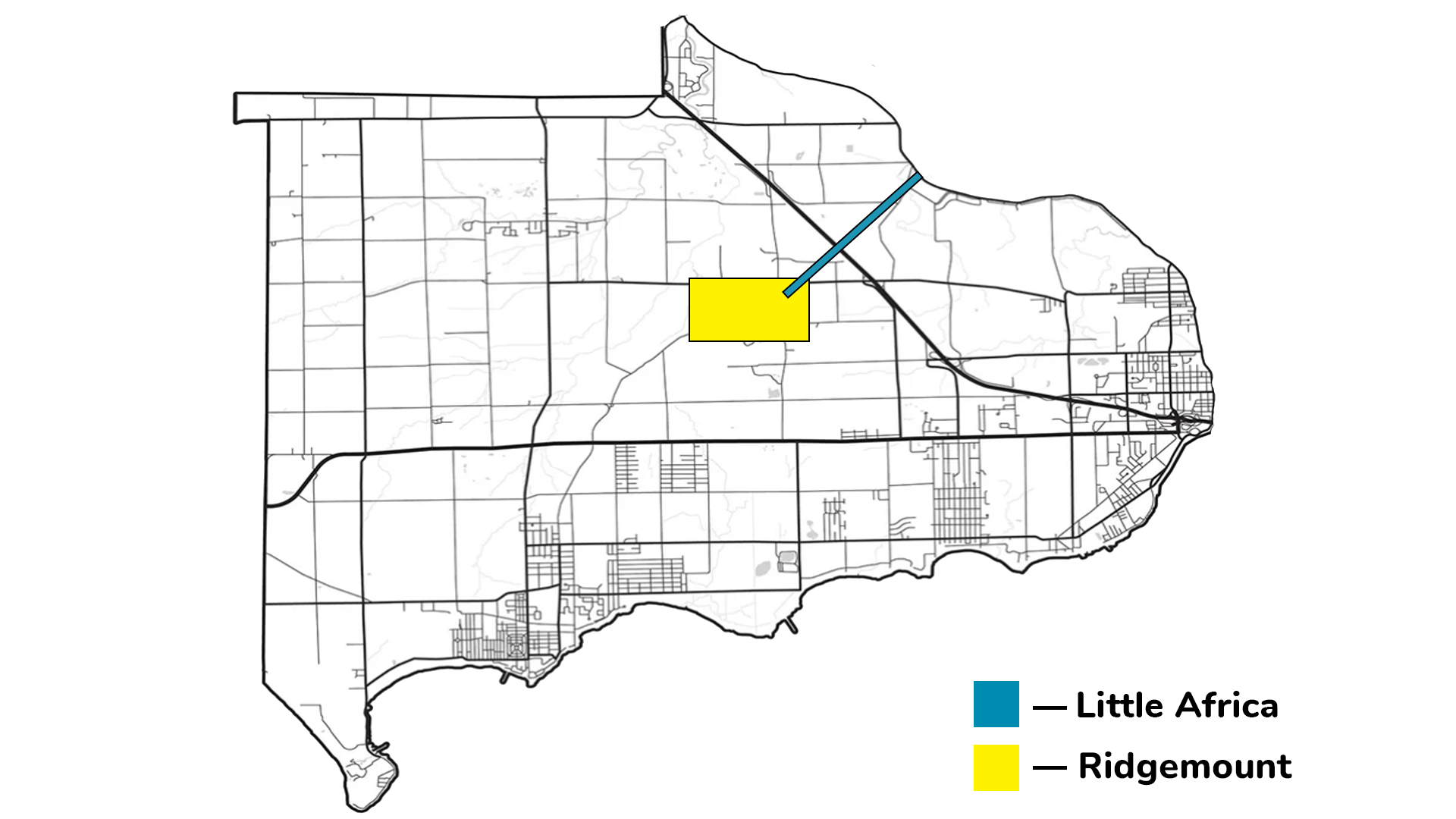
Ridgemount and Little Africa
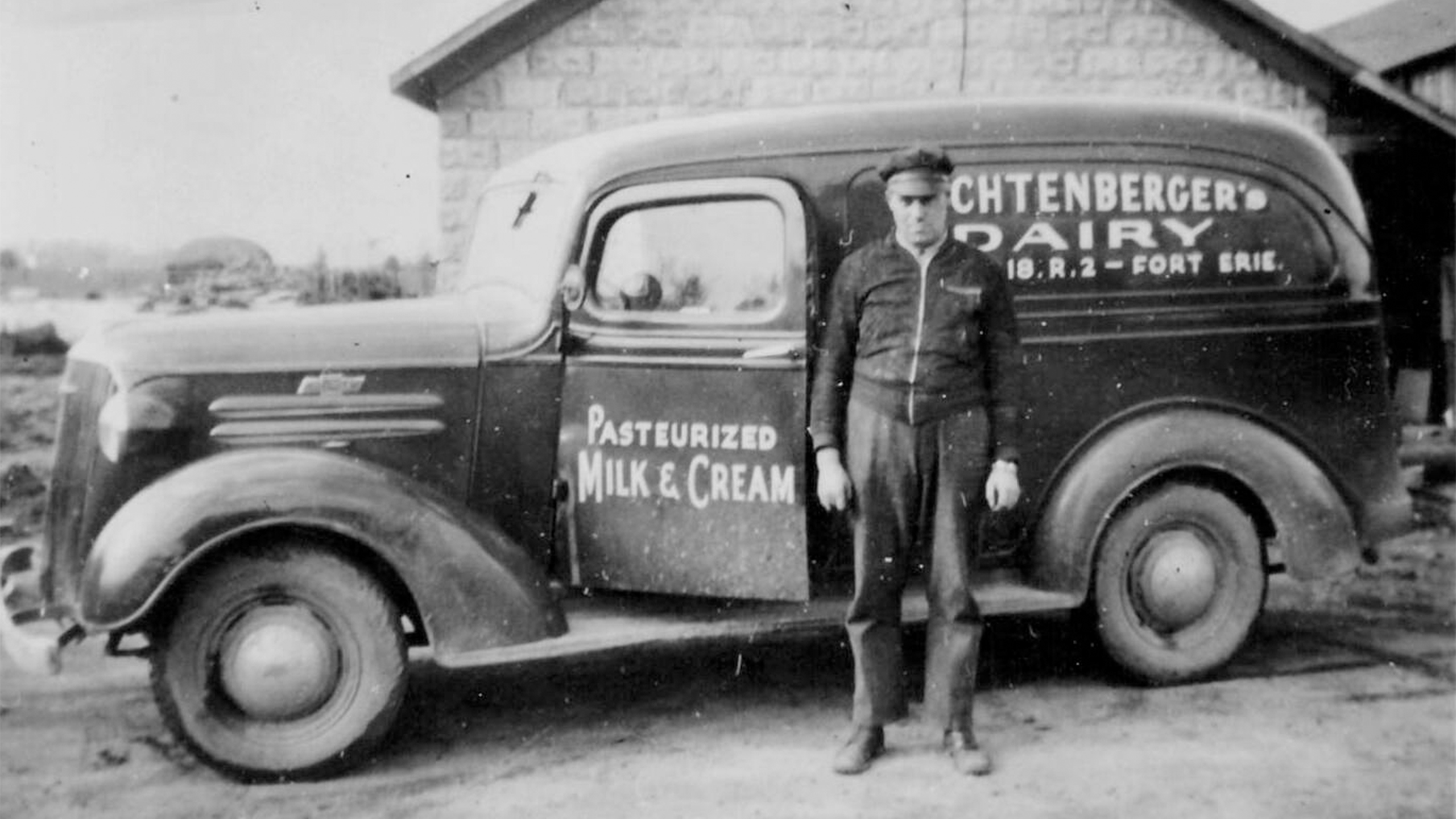
The Ridgemount post office, granted in 1887, served the rural community around present-day Ridgemount and Bowen Roads. The businesses that developed were agricultural. Lichtenberger Dairy, for example, was run out of the family farm located on Sunset Drive.
In the mid-1800s, a small community locally known as Little Africa was settled by former slaves escaping to freedom. The community was prosperous and had its own stores and a church. In 1840, the population was about 80 and grew to about 200 before 1880. At one time, Little Africa represented one of the largest communities in Bertie Township.
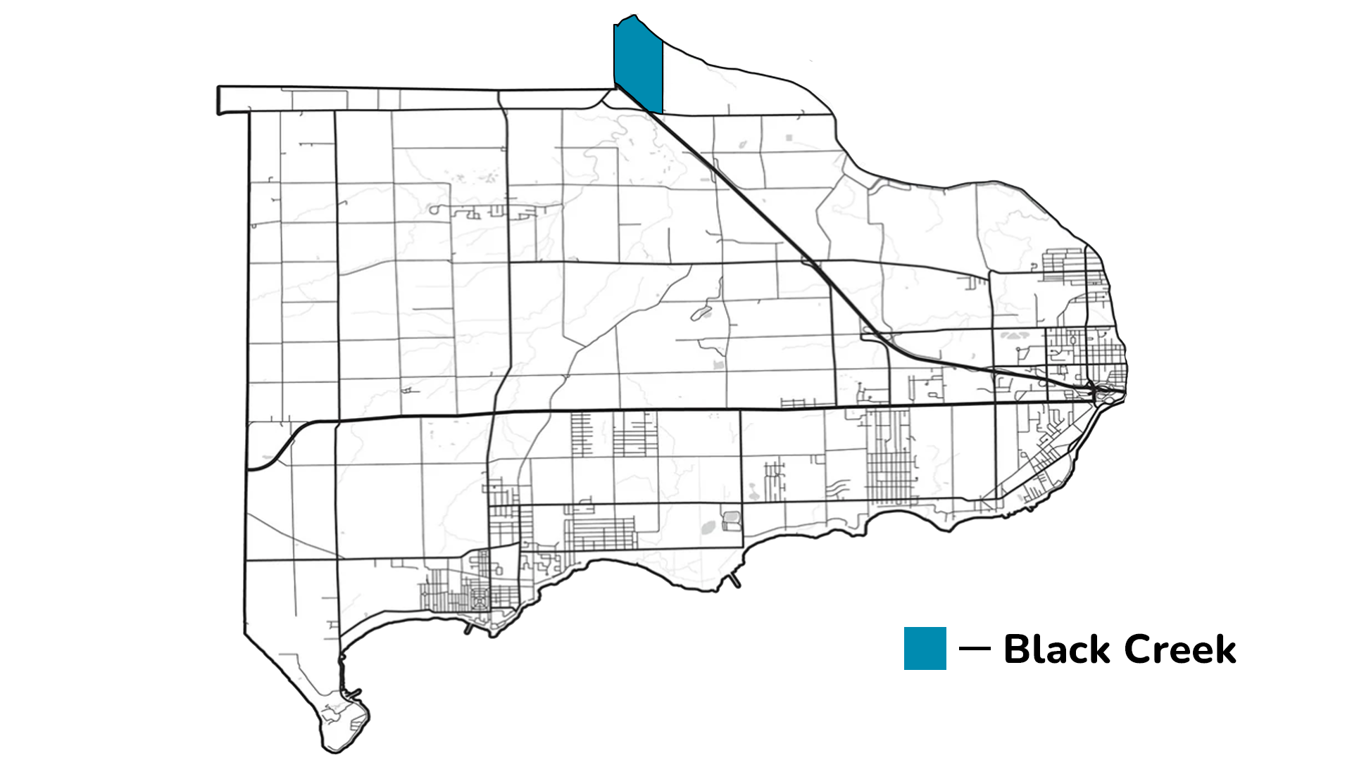
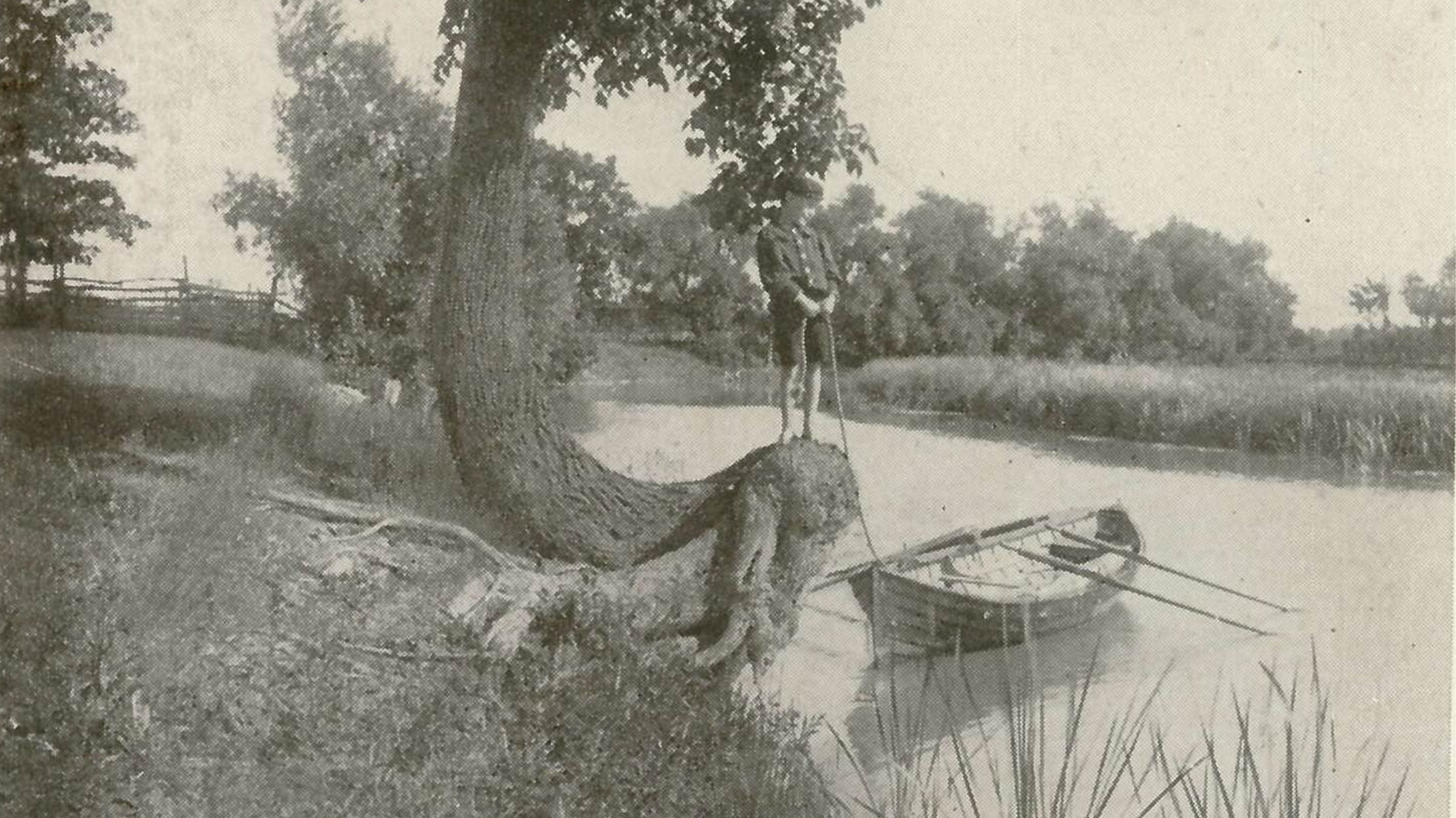
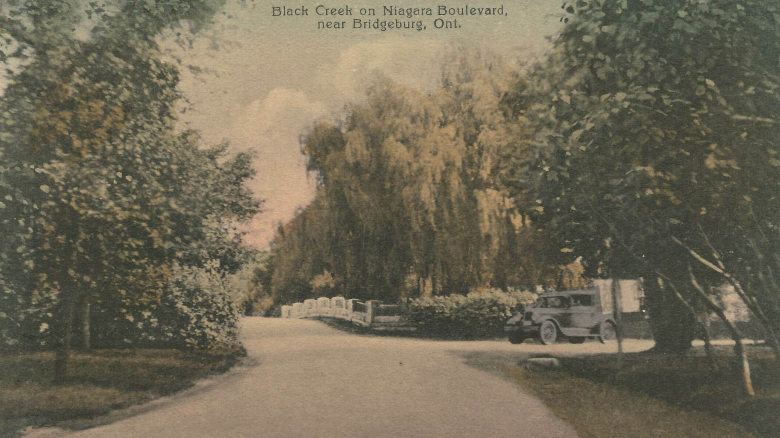
Black Creek
The community of Black Creek was located halfway between Fort Erie and Niagara Falls and was once part of Willoughby Township. Its location along the Niagara River Road and the creek made it one of the first areas settled by United Empire Loyalists in the late 1700s. (Photo A)
This community acted as a midpoint stop for travelers going between the larger towns of Fort Erie and Niagara on the Lake. When townships were abolished in 1970, the boundaries of Black Creek became part of greater Fort Erie. The photo shows the view of Niagara Boulevard looking south just before the bridge over Black Creek. (Photo B)
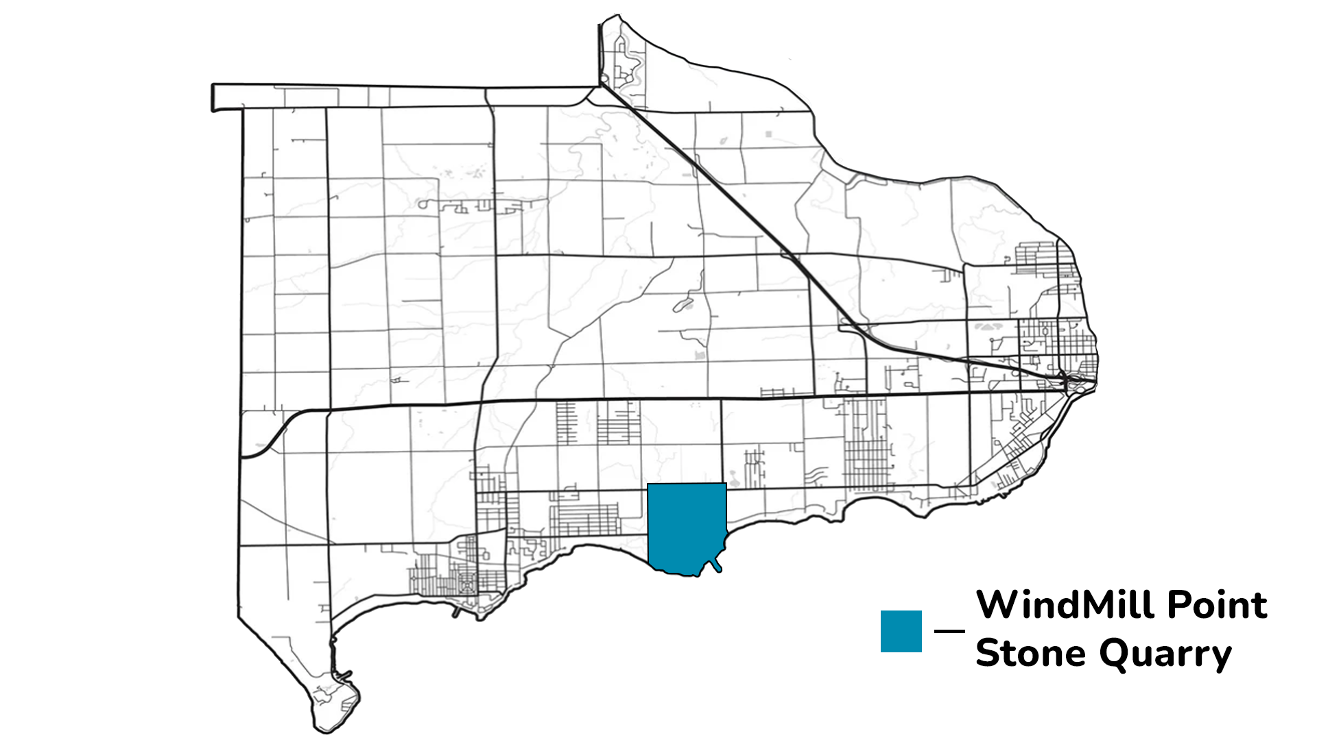
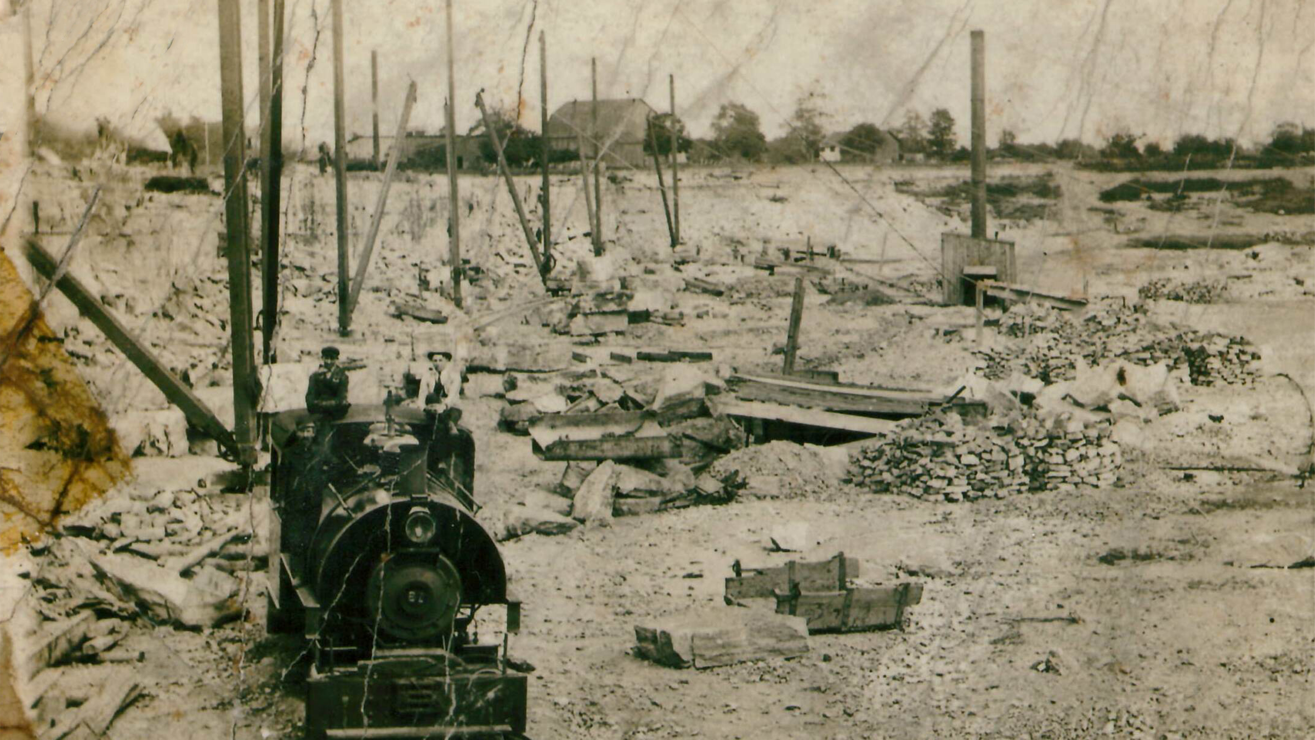
Windmill Point/Stone Quarry
The community that existed around Stonemill Road between Lake Erie and Garrison Road was called both Windmill Point and Stone Quarry depending on the industrial base of the time. In 1886, a post office was granted in the name of Stone Quarry. This quarry, (c. 1911) located at Windmill Point, operated from 1895-1903 by Hughes Brothers and Bangs of Syracuse. (Stone Quarry)
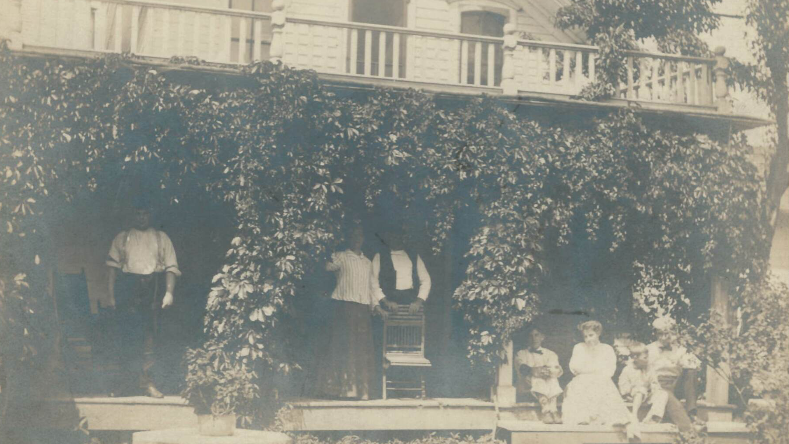
Silas Carter, a United Empire Loyalist, built a successful grist mill in 1832. For forty years, farmers from across the region would come to Windmill Point to have their wheat ground. Milling industry came to an end as quarrying grew in importance. This photo shows a cottage in Windmill Point around the late 1800s or early 1900s. (Windmill Point)
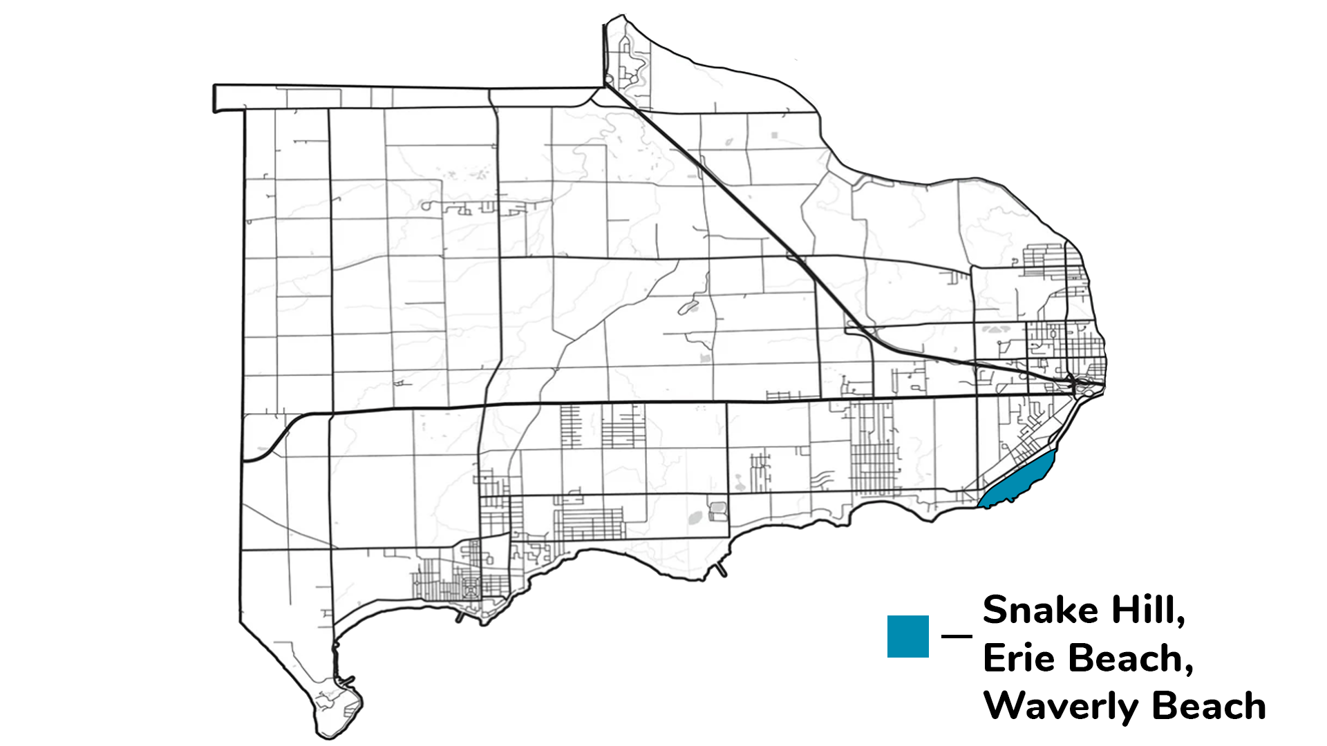
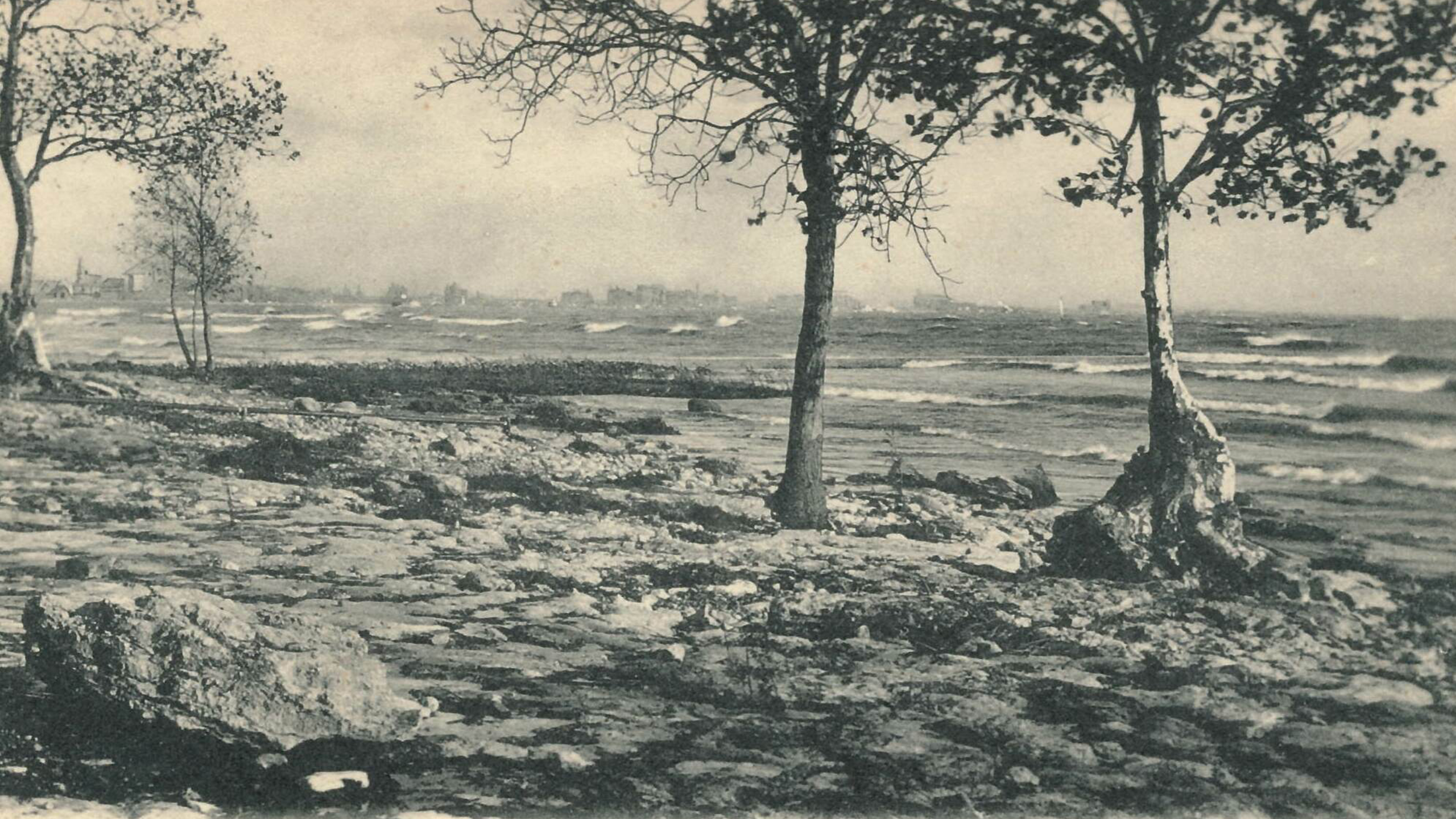
Erie Beach, Snake Hill, and Waverly Beach
In 1767 Captain Johnathan Carver sailed the Great Lakes and documented his travels. His journal devotes five pages describing the abundance of snakes in the area around the fort. This area therefore became known as Snake Hill and it was the location of a bloody battle during the War of 1812. Erie Beach later became a popular tourist destination and was the location of an amusement park until 1930. The name Waverly Beach was adopted in 1911 by the Erie Beach Association to differentiate between the Park and the residential area.
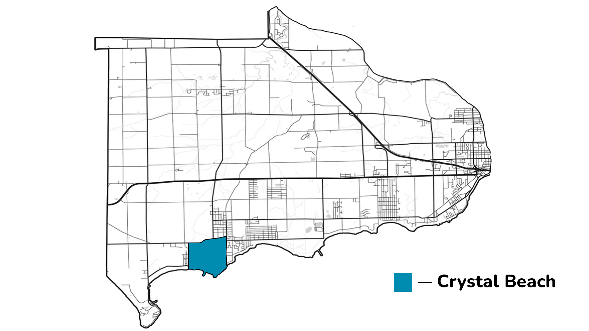
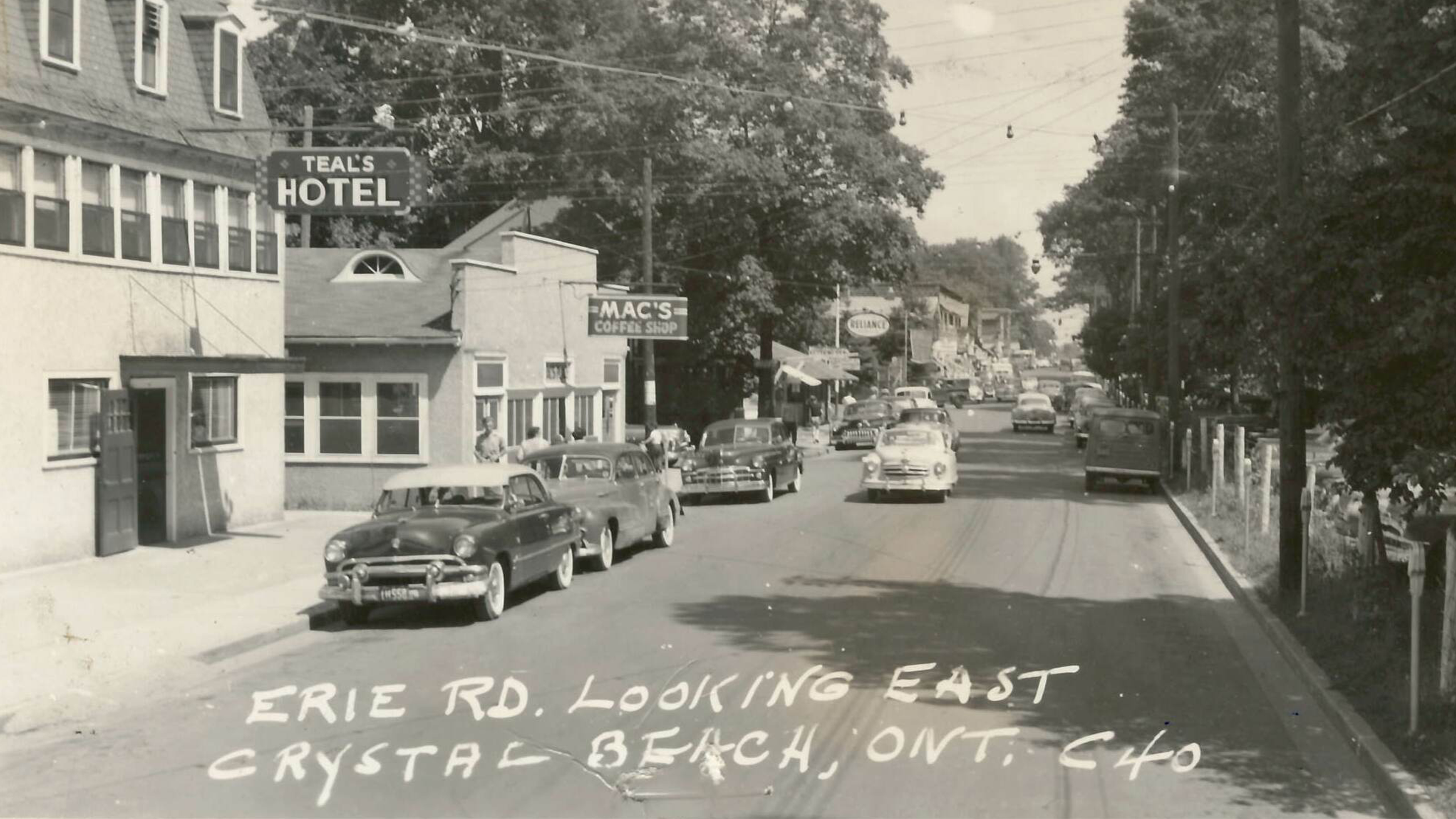
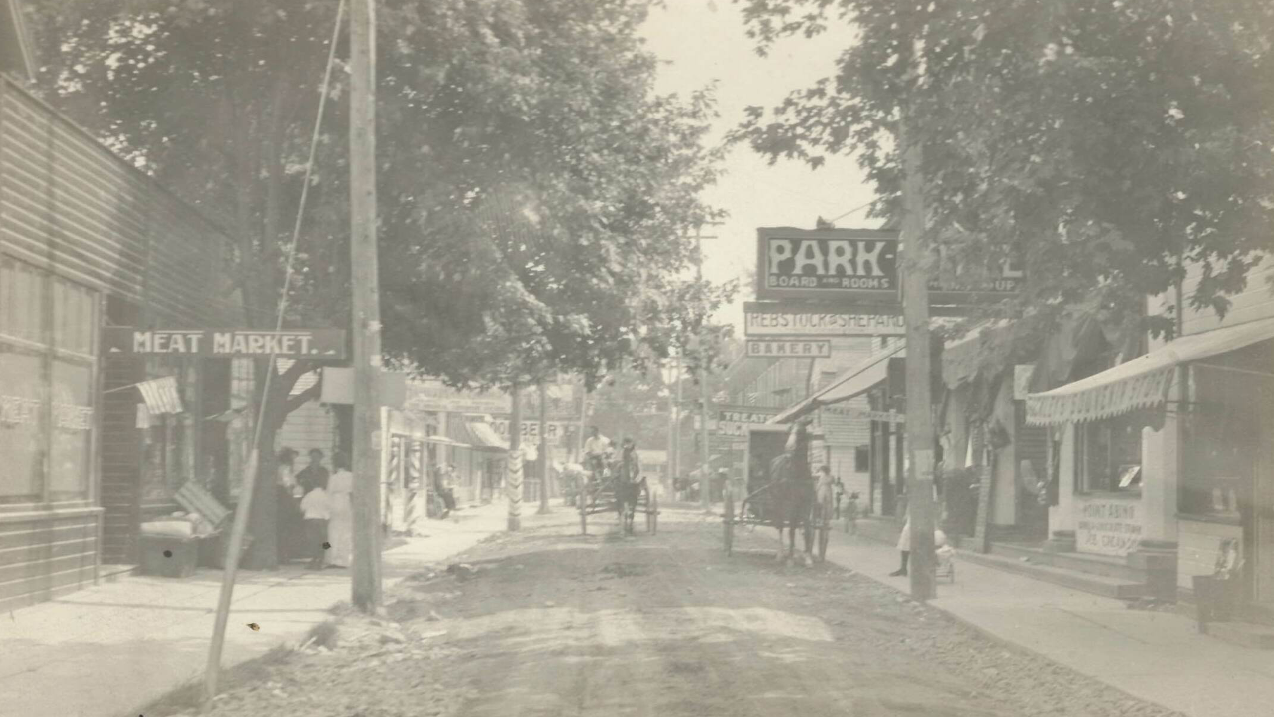
Village of Crystal Beach
The community of Crystal Beach was first settled in the late 1700s. Inspired by the white sandy beach and crystal clear waters, John Rebstock decided to create an amusement park which opened in 1890. A lucrative tourist industry turned the village into one of Canada’s largest and most popular resort centers. It was incorporated as a Police Village in 1895. The community received a summer post office in 1896 and a year-round post office in 1908. The Village of Crystal Beach was incorporated in 1921 and amalgamated with the municipality in 1970.
The community shifted to residential after the park closed in 1989.
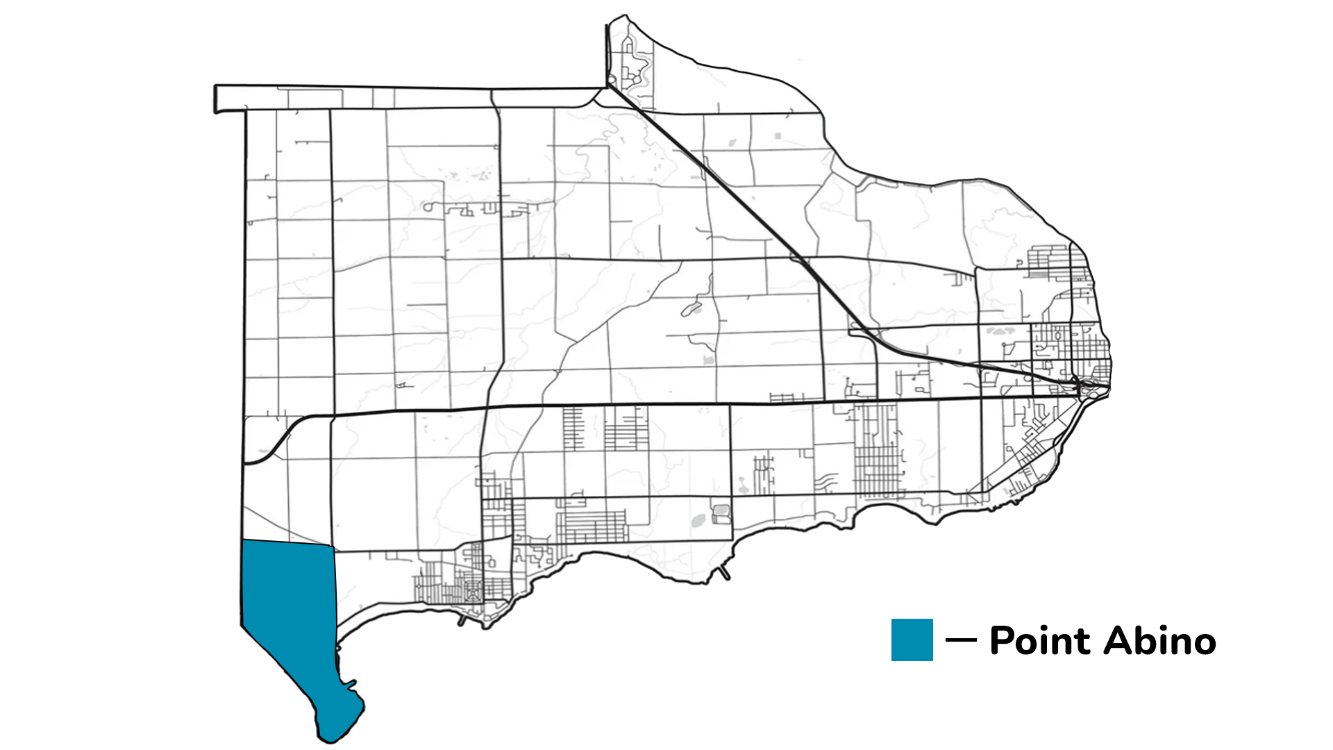
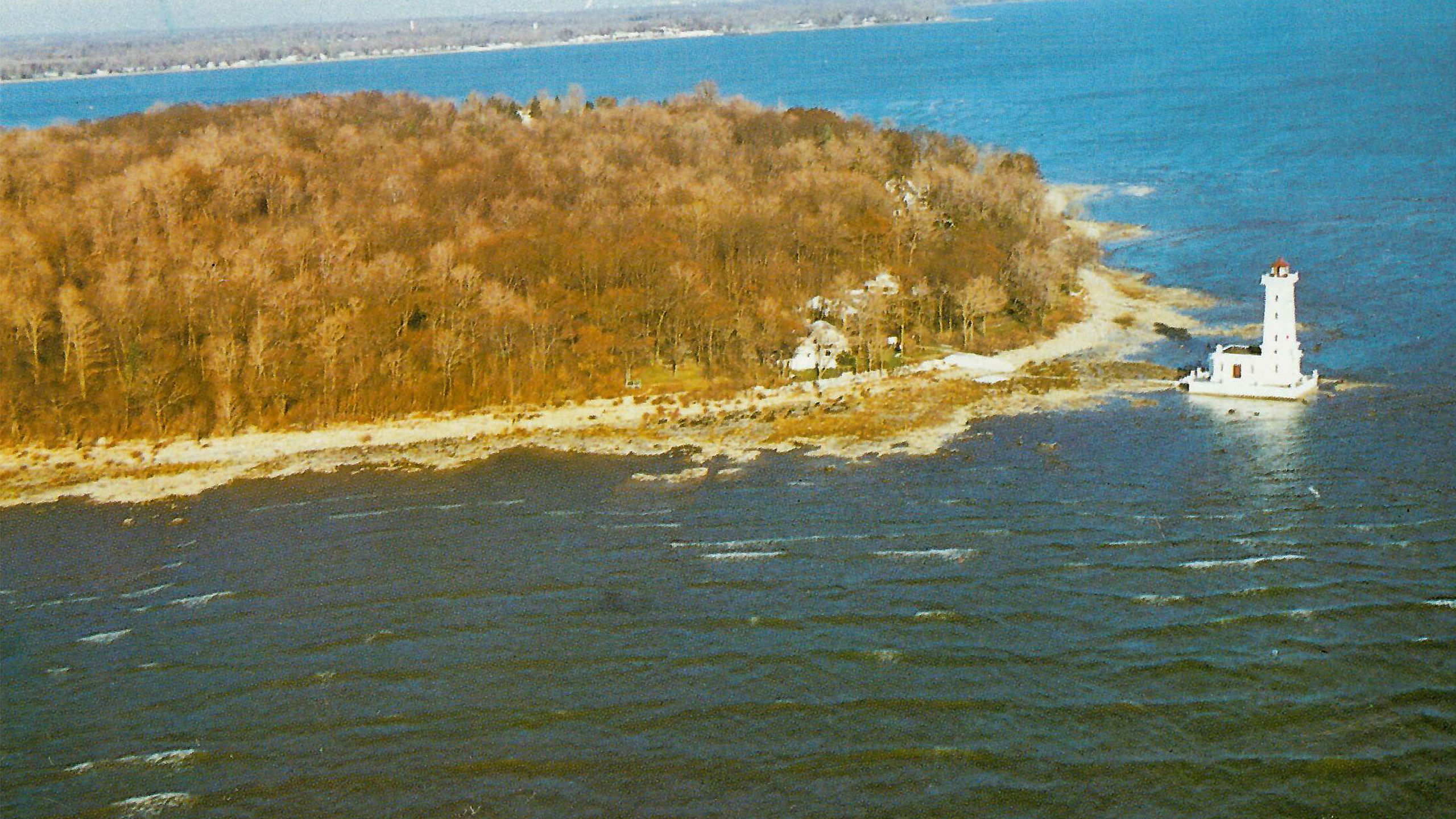
Point Abino
The first reference to a community marked as Point de Bino, is found on a map dating to 1749. A settlement within Bertie Township began in the 1790s and by 1838 a Point Abino post office opened in Crystal Beach, to serve the residents living in the Ridgeway-Crystal Beach-Point Abino area. The entire point was sold in 1892 to Buffalo businessmen who developed it into a summer colony. The lighthouse was built in 1917.
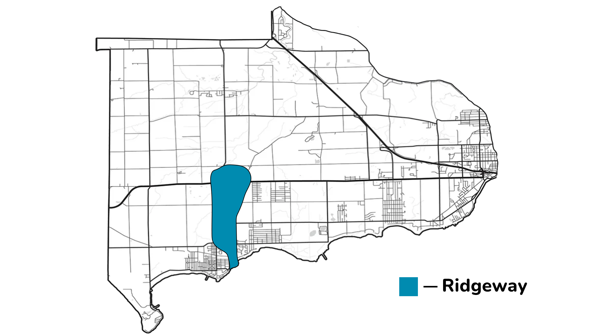
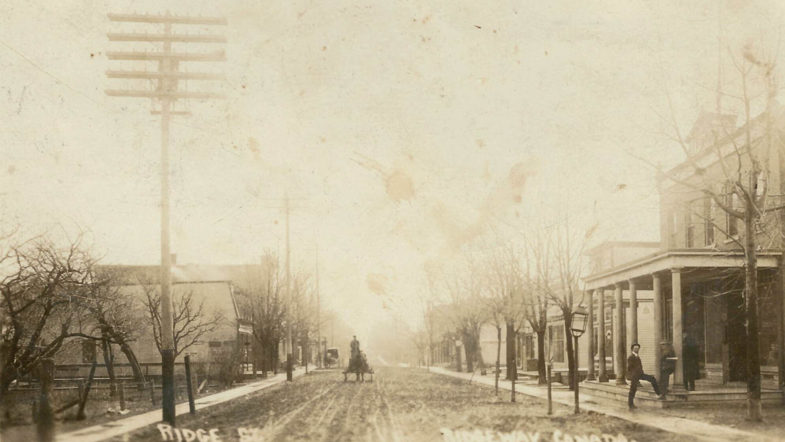
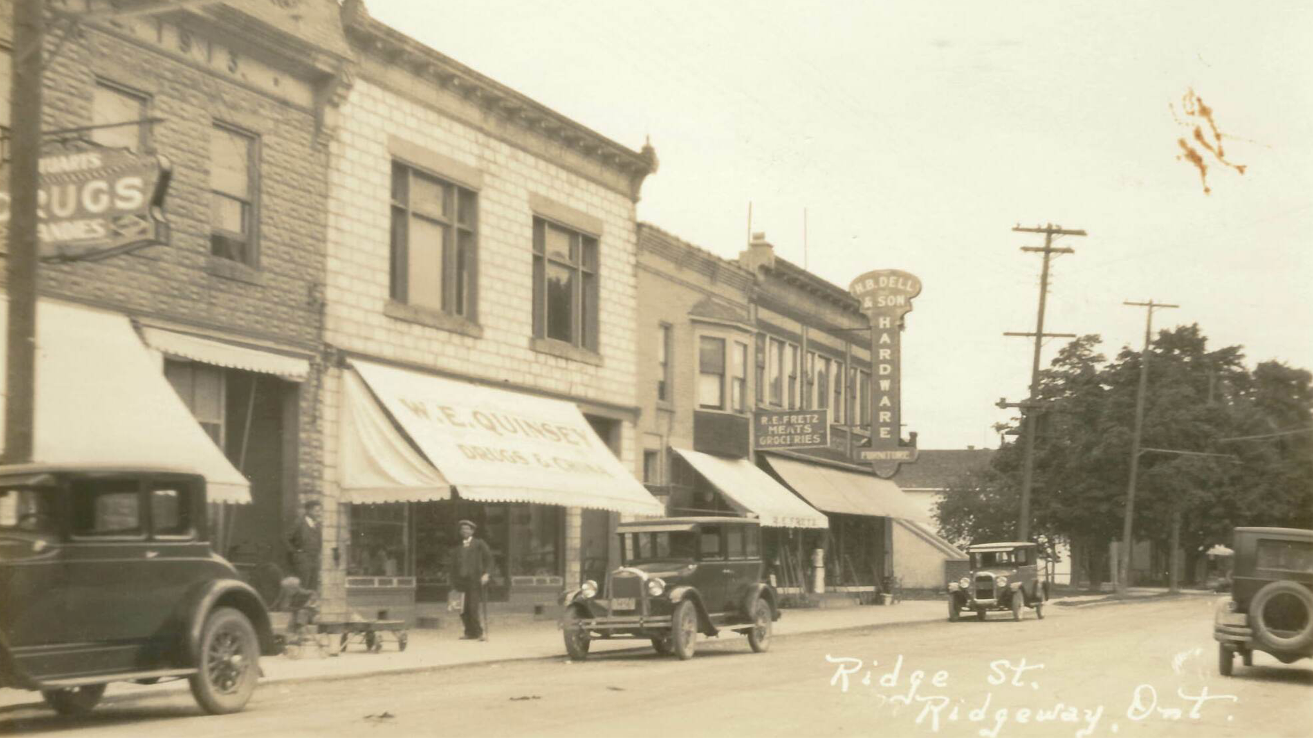
Ridgeway
Ridge Road was one of the first two wagon trails in Bertie Township, originally running from Miller’s Creek on the Niagara River to Point Abino. View of Ridge Street (Ridge Road) c. 1909. (Photo A)
The prosperity of Ridgeway did not depend on a single industry as other communities in the area did. Instead, it grew as a diversified commercial village due to the proximity of the rail line. A number of industries developed around the train stop on Ridge Road to serve passengers. Ridgeway was also the seat of municipal government for Bertie Township until the amalgamation in 1970. This is a view of the west side of Ridge Street (Ridge Road) in the 1920s. (Photo B)
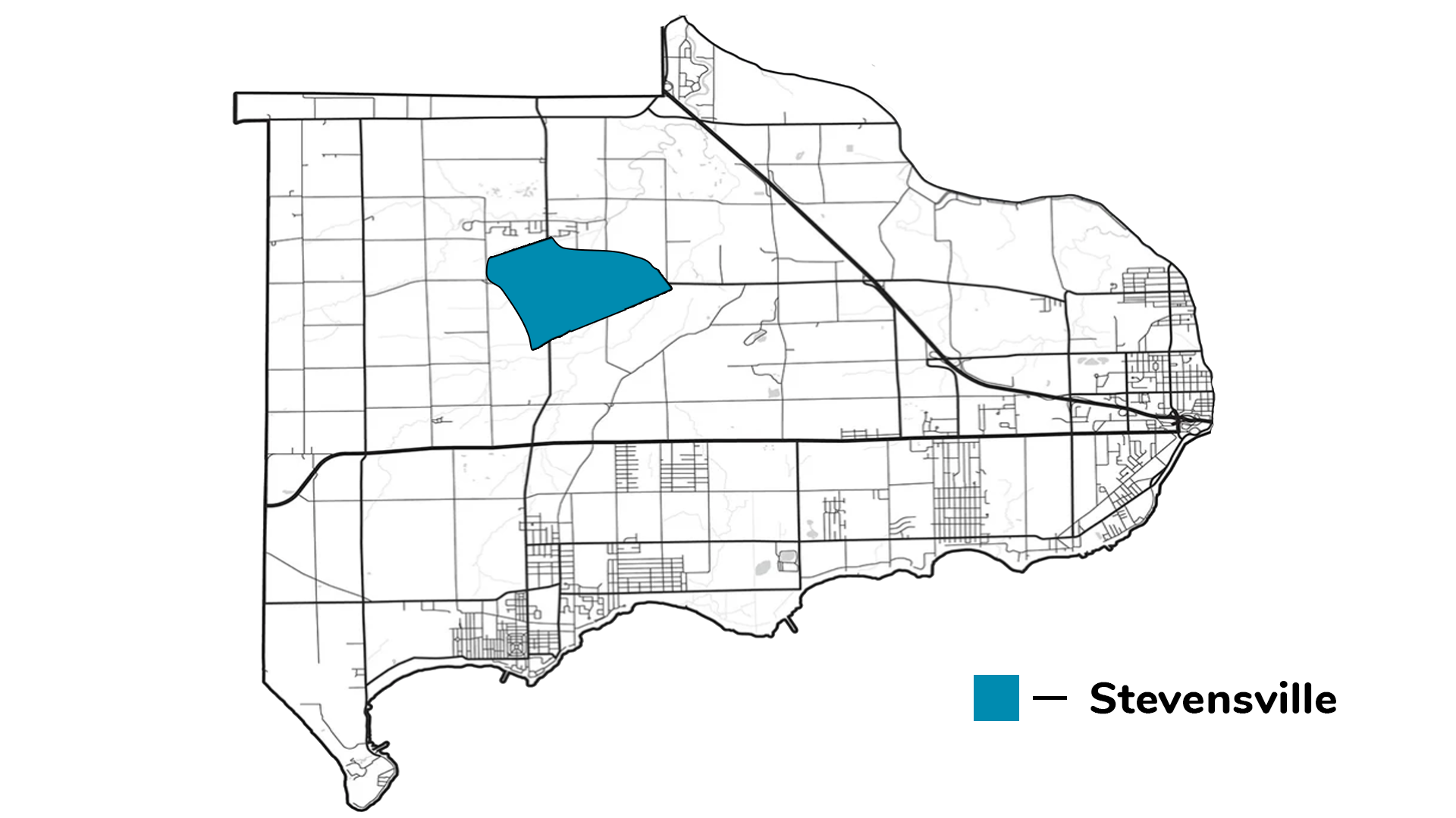
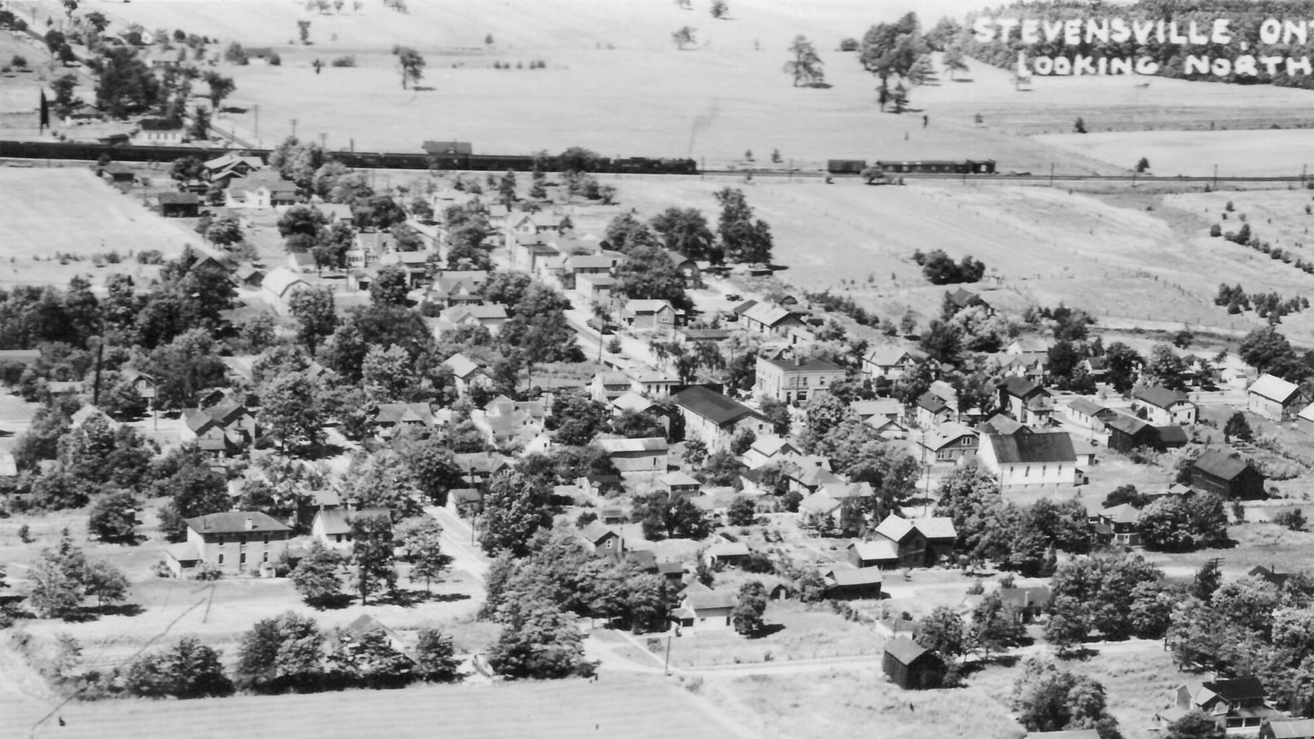
Stevensville
The early settlers of Stevensville capitalized on the natural surroundings for early commercial growth. The abundant forests allowed for a large timber and mill trade and two rail lines boosted the community’s economy by 1886. The decline of Stevensville as a commercial center is tied to the railway’s decline in importance. This aerial photo looks north over the community. A school is visible near the bottom left corner. (Photo A)
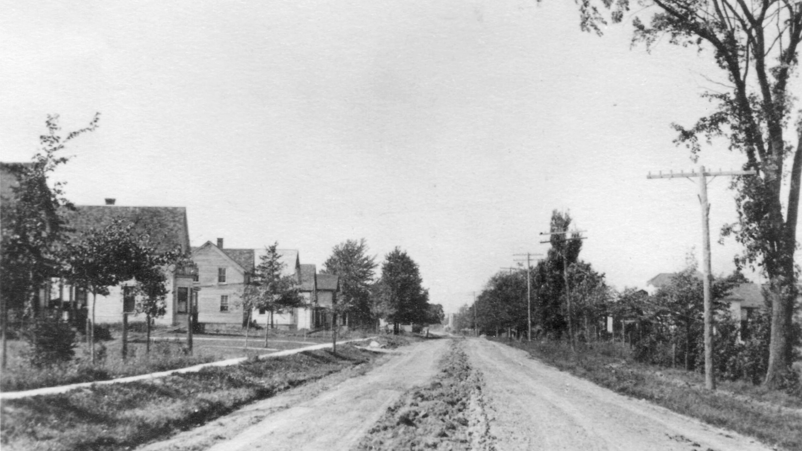
A view of East Main Street in Stevensville. Year unknown. (Photo B)
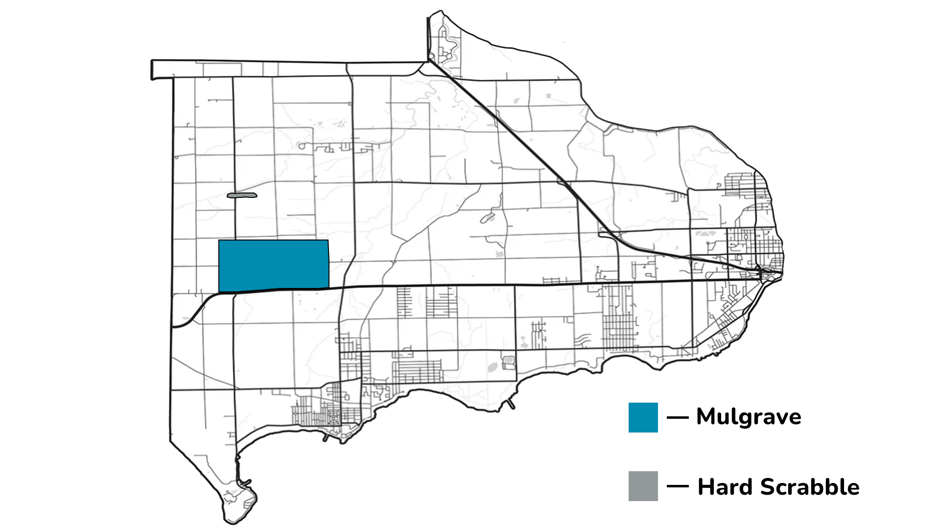
Hard Scrabble and Mulgrave
Among the villages and larger communities of Bertie Township, smaller settlements have also been identified over the years. These places have no formal boundaries, but their locations are known to the local population. Hard Scrabble was a gathering of homes on Church Road between House and Ott Roads. The small hamlet had its own school, S.S. No 8 or Hard Scrabble School which was built in 1915 and was located on the southwest corner of Fox and Point Abino Roads.
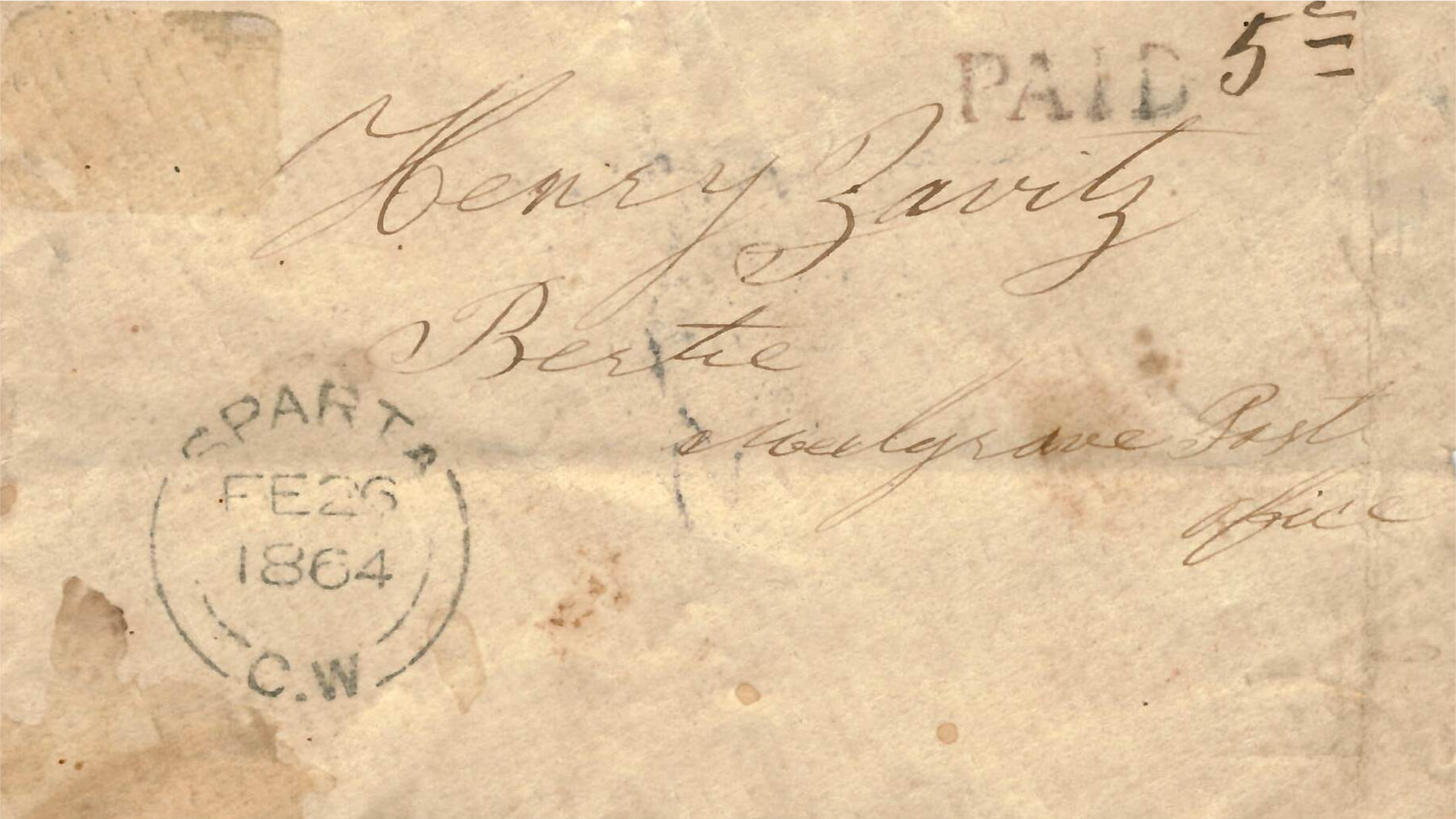
Located within Bertie Township, Mulgrave consisted of the area roughly between Point Abino Road, Ott Road, Highway 3 and Gilmore Road. It was granted a post office in 1862 with Joseph I. Zavitz as the first postmaster. The post office closed in 1914 when rural mail delivery commenced and the name Mulgrave fell into disuse.
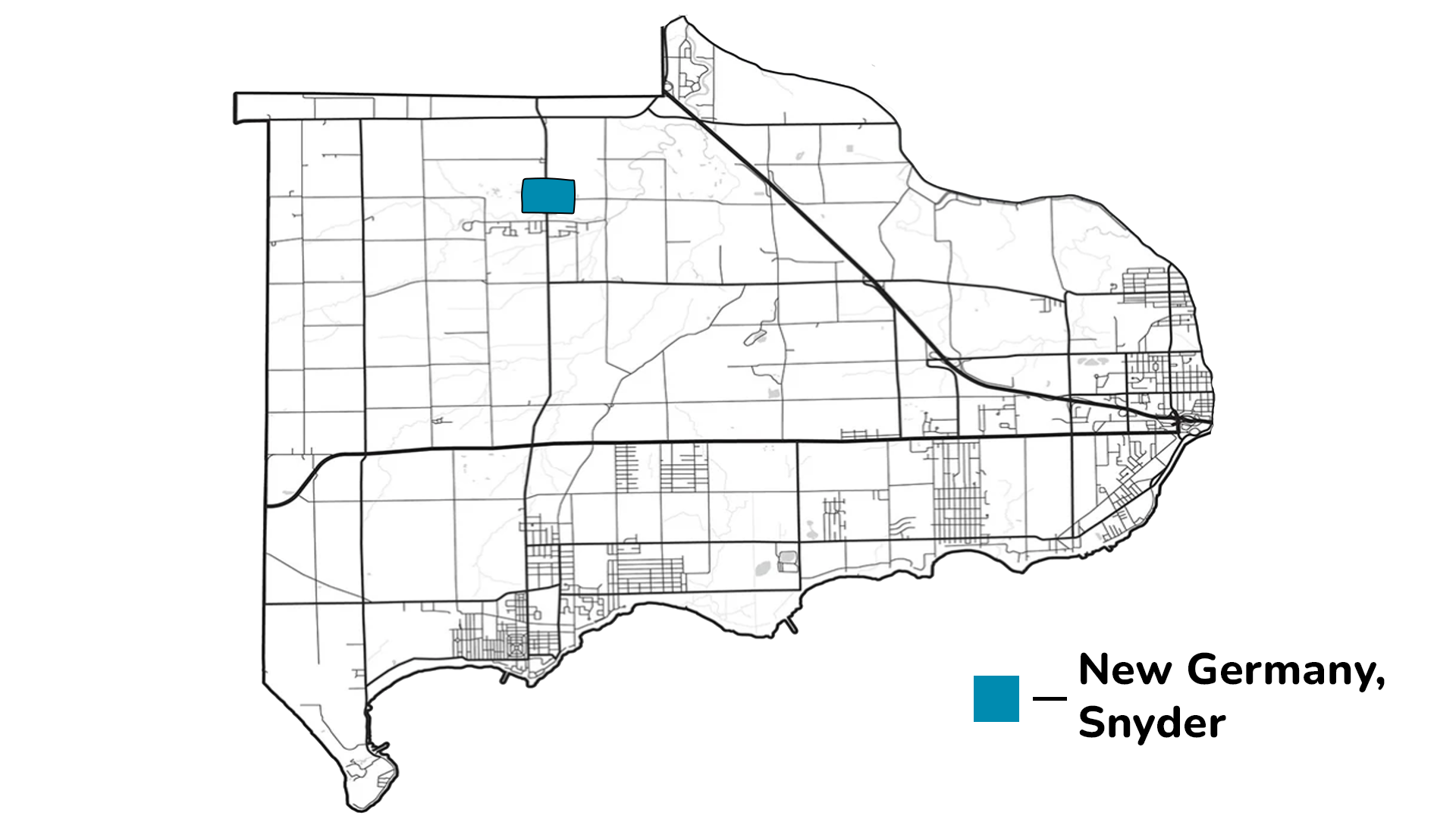
Snyder
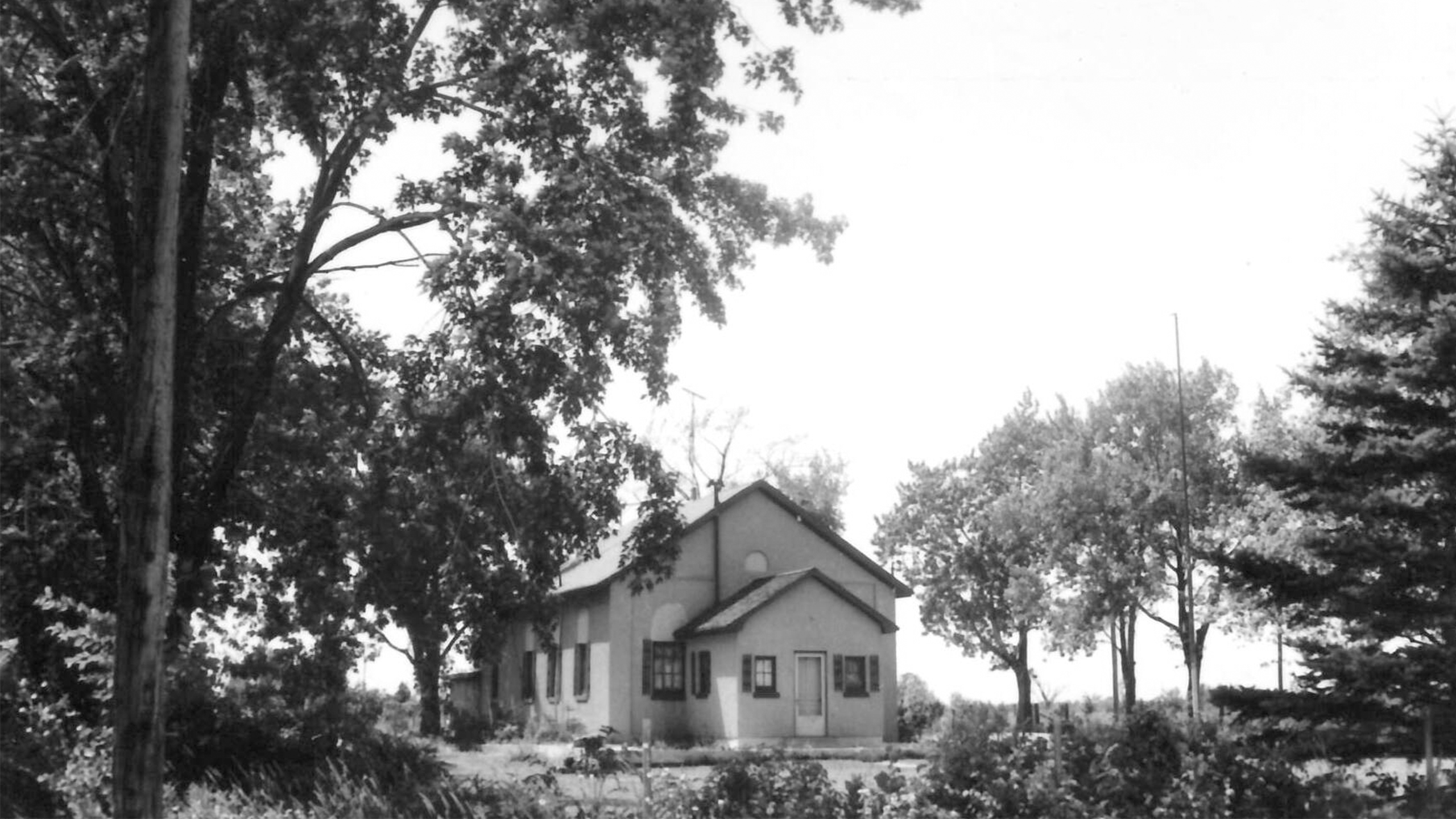
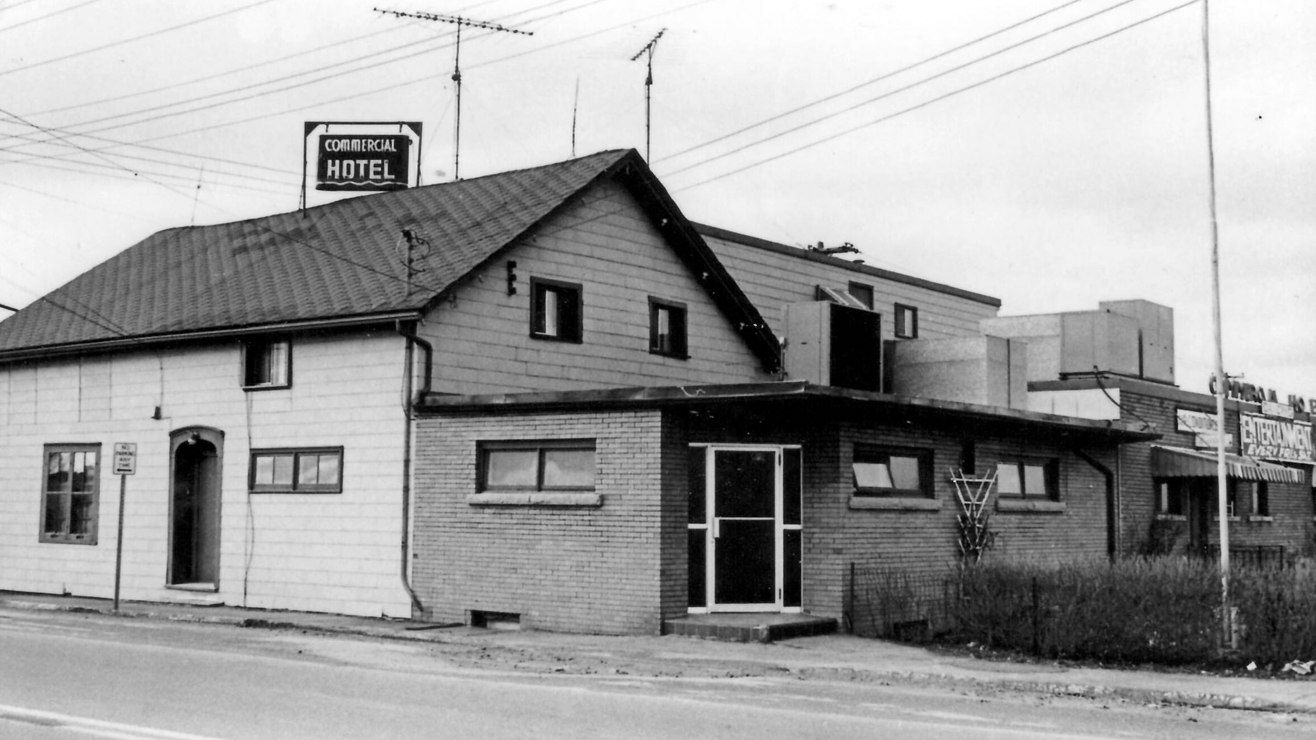
During the 1830s and 1840s there was an influx of German-speaking settlers, a fair number of which settled around the present Sodom and Netherby Road area. This portion of Bertie Township was first known as Ortville but later went by New Germany. A post office opened in 1887, changing the name to Snyder in honour of the man responsible for getting the post office in the community. The Commerical Hotel was located in the center of this community.
Sign up to our Newsletter
Sign up to receive information from the Town of Fort Erie directly to your inbox. Check out the various categories of general news, and emergency notifications.